 Napali Coast Boat Tours
The Na Pali Coast of Kauai: A Guide to the Cliffs, Valleys and the State Park
The Na Pali Coast is the 16-mile stretch of sea cliffs on the northwest side of Kauai, and it is the reason many people come to this island at all. This page covers the place itself: where it sits, how tall the cliffs are, the state wilderness park that protects it, the named valleys, the geology, the people who farmed those valley floors, and the films shot along it. If you want the boats that run it, the Napali Coast boat tours comparison covers catamarans, rafts, sunset cruises and the full-day Niihau trip in one table. The trail gets its own page too, and so do the helicopter routes and the park reservations at Haena.
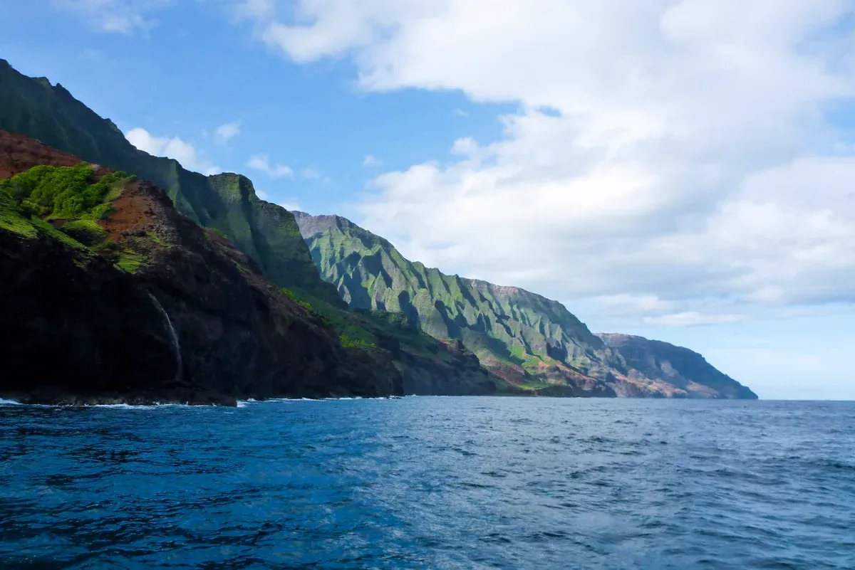
The fluted green cliffs of the Na Pali Coast rise straight out of the sea. Photo: Jim Bahn, CC BY 2.0, via Wikimedia Commons
Quick answer The coast at a glance
The Na Pali Coast runs 16 miles (26 km) along the northwest side of Kauai, Hawaii, with cliffs rising up to 4,000 feet (1,200 m) above the Pacific by Wikipedia's count. Most of it has no road. You see it by boat from Port Allen or Kikiaola, by helicopter from Lihue, on foot along the 11-mile Kalalau Trail, or from the Kokee lookouts above Kalalau Valley. Na Pali Coast State Wilderness Park covers 6,175 acres of it.
Key takeaways
- Boats are the only legal way onto most of the shore besides hiking. Compare the catamaran snorkel tours and the raft tours that enter the sea caves in one table.
- For a full day on the water, the Niihau and Na Pali Full Day trip runs 7 hours and snorkels at Lehua Crater for $339 per person.
- The Kalalau Trail is 11 miles one way from Kee Beach. The rules, permits and hazards are laid out on the Kalalau Trail page.
- Flightseeing shows the ridge line in roughly 40 to 65 minutes of airtime, depending on the operator. What the routes cover and when to fly is on the Na Pali Coast helicopter tour page.
Where the Na Pali Coast Is and What Is There
Na Pali means the cliffs, and the name does the describing. The coast sits on Kauai's northwest shore, between two beaches you can drive to.
Location, Length and Cliff Heights
The Na Pali Coast runs along the northwest side of Kauai, one of the eight main Hawaiian Islands. Hawaii State Parks measures the Napali Coast at 16 miles, running from Polihale Beach in the southwest to Kee Beach in the northeast. Go Hawaii and one tour operator put it at 17 miles, so sources differ by a mile. Call it 16 to 17 miles and you are covered.
The cliff heights also carry a conflict. Wikipedia says the Na Pali cliffs rise as much as 4,000 feet (1,200 m) above the Pacific, a figure Capt Andy's repeats. Blue Hawaiian, a helicopter operator, describes the coast as 17 miles of 3,000-foot sea cliffs. Both numbers appear in print. What the sources agree on is that no road crosses them.
Polihale State Park marks the southwestern end. Its dunes reach nearly 100 feet and the access road is a dirt sugarcane haul road where four-wheel drive is preferable. Polihale is the most western publicly accessible area in Hawaii. At the northeastern end, Kee Beach sits at the end of Highway 560 and is the Kalalau Trail trailhead.
Between those two beaches, the stretch from Polihale to Kalalau Beach can only be reached by boat or helicopter. The state says boat is the only legal way to reach the Na Pali shore areas other than hiking, through permitted concessionaires. Hawaii State Parks puts the Napali park 41 miles from Lihue Airport via Haena State Park, and Go Hawaii says Haena and the coast lie about 90 minutes north of Lihue. Go Hawaii also describes the coast as largely inaccessible by land or water, which is the honest warning.
The protected area has two layers. Na Pali Coast State Wilderness Park covers 6,175 acres (2,499 hectares) and was established in part to protect Kalalau Valley. Next to it, Hono O Na Pali State Natural Reserve was established in 1983 and extended to 3,578 acres in 2009. The park holds deep narrow valleys that end at the sea, waterfalls, and extensive stone-walled terraces on the valley floors. Camping areas on the coast are Kalalau, Hanakoa and Milolii, all needing a permit.
One dated note on access. Hurricane Lowell closed all Kauai state parks from September 8, 2026, including the Na Pali Coast. DLNR lists Kikiaola Small Boat Harbor as closed until further notice, and at Port Allen the launch ramp reopened on October 2, 2026 while slips and moorings stayed closed. Confirm the current status and your departure point with the operator before you drive anywhere on this coast.
The Valleys, Beaches and Sea Caves
Six valleys and a handful of sea caves carry the names you will hear from every captain. The valleys were cut by water flow starting about 5 million years ago, and each ends at the ocean with a beach, a waterfall or both. Kalalau is the largest and the only one with a trailhead connection, via the 11-mile Kalalau Trail.
Honopu is the one no boat may land on. Nualolo Kai is the reef that three permitted raft operators can land on for snorkeling. The table below gathers what each place is and how you see it, with the figures drawn from the state, Wikipedia and the tour operators who run the water.
| Valley or site | What it is | Seen from |
|---|---|---|
| Kalalau Valley | Ringed by cliffs more than 2,000 feet high, with an accessible floor about 2 miles long and 0.5 mile wide. Campground at the beach, permit required. | The Kalalau Trail, boats offshore and helicopters |
| Hanakapiai | Stream and beach 2 miles in on the Kalalau Trail, a moderately strenuous stretch. The falls lie 8 miles round trip from the trailhead. | On foot from Kee Beach, the first leg only, no permit needed to mile 2 |
| Hanakoa | Valley and campsite at about the 6-mile mark of the Kalalau Trail. One night camping allowed with a valid Kalalau permit. | On foot only, past Hanakapiai |
| Honopu | Valley with a 0.25-mile beach known as Cathedral Beach. No boat or aircraft may land, visitors must swim from an offshore boat or from Kalalau Beach. Honopu Arch is described as roughly 90 feet tall, the tallest natural arch in Hawaii. | Boats pass the arch and the beach, and visitors swim in from an offshore boat or from Kalalau Beach |
| Nualolo Kai | Nualolo Kai is the nearshore reef where Captain Andy's, Kauai Sea Tours and Na Pali Explorer hold permits to land snorkelers when ocean conditions permit. | Permitted raft landings at the Nualolo Kai reef |
| Milolii | Valley and camping area at the southwestern end of the coast, capped at 3 days per stay and permit only. | By boat, since no road reaches it |
| Open Ceiling Cave (Pukalani) | A closed lava tube whose ceiling collapsed through wave erosion. The name means hole into the heavens. Entry depends on daily ocean conditions and it can only be reached by boat. | Raft tours enter when the sea allows |
| Waiahuakua Sea Cave | Called the largest sea cave on the Na Pali Coast at about 1,155 feet long, with a separate entrance and exit, the Double Door. A waterfall runs near the entrance. | Raft tours, best on morning departures |
| Honolulolo Sea Cave (Pirates Cave) | Described as three caves in one: Zebra, Skull and Godzilla Egg caves, with a waterfall over the entrance. | Boat tours when the sea allows |
| Hanakoa sea arch | A sea arch below Hanakoa Valley, visible in calm conditions. | Raft tours in calm conditions |
Sources: Hawaii DLNR, Na Pali Coast State Wilderness Park, Go Hawaii, Napali Coast
People, Geology and Film
The cliffs are young in geological terms and old in human ones. Both stories shape what you see from a boat today.
How the Cliffs Were Built
Kauai itself is about 5 million years old, an eroded shield volcano formed as the Pacific Plate passed over the Hawaii hotspot. The Na Pali valleys were carved by water flow starting about 5 million years ago, which makes the valleys nearly as old as the island. Rain did the cutting. Mount Waialeale, the volcano's high point at 5,148 feet (1,569 m), averaged more than 373 inches of rain a year since 1912, with a peak of 683 inches in 1982, and that water ran off the northwest flank for millennia.
The result is the fluted ridgework you see from the water: narrow valleys ending at the sea, waterfalls dropping from the cliff tops, and sea caves cut into the base of the escarpment. Open Ceiling Cave shows the process in action. It was a closed lava tube whose roof collapsed through wave erosion, leaving the hole that gives it the Hawaiian name Pukalani, meaning hole into the heavens. Waiahuakua is called the largest sea cave on the coast, at about 1,155 feet long. The stone-walled terraces on the valley floors are the human layer on top of the geological one.
Settlement, Trade and the Emptying Valleys
Polynesian navigators first settled the Na Pali coast around 1200 AD, followed by a Tahitian migration, per Wikipedia. The valleys became working communities. Kalalau's residents farmed taro on extensive terraced fields, and the terraces on the valley floors are still listed by the state as a feature of the park. The Na Pali valleys served as a trade hub connecting Hanalei, Waimea and Niihau.
Captain Cook visited Kauai in 1778. After contact, the native population of the Na Pali valleys declined as Western diseases arrived. Native Hawaiians lived in Kalalau Valley into the 20th century, farming taro on the terraces. State park designation prohibits permanent residence in Kalalau.
The terraces remain fragile. Invasive tree roots are damaging the stone walls of Kalalau's terraced gardens, and the valley is home to two endangered endemic plants, Dubautia kalalauensis and Schiedea attenuata. That is part of why landing rules are strict. First-offense illegal camping citations at Kalalau carry fines up to $500, and only three permitted raft operators may land at the Nualolo Kai reef.
Films Shot on the Na Pali Coast
Kauai has featured in more than 70 Hollywood movies and TV shows, and the Na Pali area carries a good share of them. Jurassic Park (1993) used Napali aerial footage and Kalalau Trail filming, with the coast standing in for Isla Nublar. Hurricane Iniki struck on September 11, 1992, the last day of that filming. King Kong (1976) used Kalalau Valley as Skull Island. Honopu Beach served as Shipwreck Cove in Pirates of the Caribbean: On Stranger Tides (2011). Six Days Seven Nights (1998) filmed at Honopu Arch, Makawehi Bluff and the Nualolo Trail.
The list goes back further and forward too. South Pacific (1958) made Makana Mountain at Haena famous as the real Bali Hai peak. George of the Jungle (1997), Hobbs & Shaw (2019) and the 1976 King Kong round out the films Kauai Now News names for the Napali area. Honopu Arch and the Kalalau cliffs can be seen from the water. Manawaiopuna Falls in Hanapepe Valley, the 400-foot waterfall in the background of Jurassic Park, is a helicopter stop instead. Wikipedia says landing there was banned until 2009, when Island Helicopters got permission for limited weekly visits.
The Na Pali Coast of Kauai
A traveller films the Napali Coast of Kauai from the water. Third-party video by Farm Fresh World. This site did not shoot it and has no relationship with the creator.
Four Ways to See the Na Pali Coast
There is no road along the cliffs. The stretch between Polihale Beach and Kalalau Beach can only be reached by boat or helicopter, and the state names boat as the only legal way to reach the shore areas other than hiking.
Compare the Four Options
Each way shows a different face of the coast. Boats run at water level past the cliffs and, on the right trips, the sea caves and a snorkel stop. Most helicopters lift from Lihue and reach the full landscape, including areas unreachable otherwise. The Kalalau Trail covers 11 miles one way from Kee Beach to Kalalau Valley and needs permits past the 2-mile point. The Kokee lookouts give views down into Kalalau Valley from the rim. The table sums up what each one shows, how long it takes and who it suits.
For the helicopter side in detail, see the Na Pali Coast helicopter tour page. For the trail, including permits and hazards, see the Kalalau Trail guide, and for entry reservations to Haena State Park at the trailhead, see the Haena State Park page.
| Way | What you see | Time | Who it suits |
|---|---|---|---|
| Boat tour | Cliffs at water level, sea caves like Open Ceiling Cave, Honopu Arch, a snorkel stop on the trips that include one | 3 to 7 hours depending on the trip | Most visitors, including families on catamarans |
| Helicopter | The full landscape from above, valleys and ridges unreachable otherwise | About 40 to 65 minutes of airtime | Short trips, photographers, anyone avoiding boats |
| Kalalau Trail | Kee Beach, Hanakapiai Beach at 2 miles, then the full 11-mile route to Kalalau with a permit | A day trip to mile 2, several days for the full trail | Fit hikers with permits or reservations |
| Kokee lookouts | Kalalau Valley and Waimea Canyon from the rim, 3,000 feet deep | By road, no boat or flight needed | Drivers who want the view without a boat or a hike |
Boat Tours in Short
Boats are the most bookable option and the only way onto the water. Catamaran snorkel trips from Port Allen run 4.5 to 7 hours, like the Holo Holo Sail and Snorkel at $274 per person with breakfast and a deli lunch on board, or the Amelia K Boat Tour at $227.13 with a 4.9 rating across 2,065 reviews. Some raft trips leave from Kikiaola and enter the sea caves when the sea allows, though that harbor is listed as closed until further notice, so confirm the departure point with the operator.
The full side-by-side comparison of departure harbors, durations, inclusions and prices sits on the Napali Coast boat tours homepage.
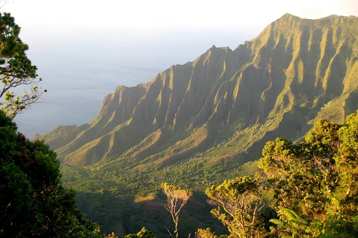
Kalalau Valley and the eroded green cliffs of the Na Pali Coast in late afternoon light. Photo: Dcrjsr, CC BY 3.0, via Wikimedia Commons
When to Go and What Is Closed
Season matters more on this coast than almost anywhere in Hawaii. Summer calms the sea, winter swell can limit cave entry and roughen the ride, and Hurricane Lowell closed state parks and harbors.
Summer Against Winter Seas
Summer lowers the north-shore swell and brings steadier trade winds, which is why Makana Charters calls June through August the busiest stretch on the water, with fewer cancellations and better access to the sea caves and Nualolo Kai. Raft tours become significantly rougher in fall, per Hawaii Guide, while catamarans run year-round, with earlier departures and shorter snorkel stops in fall. Morning departures have better conditions and afternoons turn bumpier as the wind picks up.
Winter brings humpback whales, roughly December to April with the peak from January to March, though winter and spring swells are more common, per Capt Andy's. Sea cave entry depends entirely on ocean conditions and is never guaranteed, whatever the month. Weather cancellation by the operator brings a full refund per Holo Holo, and tours proceed in rain unless lightning is a safety concern.
Trail and Park Rules
The Kalalau Trail starts at Kee Beach at the end of Highway 560, inside Haena State Park, which caps entry at 900 visitors a day and needs advance reservations. Hiking beyond Hanakapiai at mile 2 requires a valid Na Pali camping permit, and no day-use permits are issued past that point. Kalalau permits cap stays at 5 consecutive nights, Hanakoa allows one night and Milolii allows 3 days.
Camping permits release 90 days ahead and often sell out months in advance in summer. No commercial boat may legally drop passengers at the Kalalau or Milolii camping areas, and kayak landings are allowed only at Kalalau and Milolii.
Hurricane Lowell Closures
Hurricane Lowell closed all Kauai state parks from September 8, 2026, including the Na Pali Coast. After the storm, Port Allen Small Boat Harbor had closed slips and moorings with extensive damage, and its launch ramp reopened on October 2, 2026 while the slips stayed shut. DLNR lists Kikiaola Small Boat Harbor, the departure point for several raft operators, as closed until further notice. Haena State Park was listed as scheduled to reopen on October 15, 2026, with day hiking to Hanakapiai Beach and Falls open but the trail beyond mile 2 and all Kauai camping closed until further notice.
None of this predicts the situation on your travel day. Check the official status of the parks and harbors before you go, and confirm the vessel, check-in address and operating status with the operator before driving.
Tips for Visiting the Na Pali Coast
Do
- Do book a morning departure, because operators including Na Pali Riders and Holo Holo report calmer morning conditions and bumpier afternoons as the wind picks up.
- Do reserve Haena State Park entry up to 30 days ahead if you plan to hike (the October 15 reopening notice says two weeks, so confirm the window), because the park caps entry at 900 people a day and slots sell out within minutes for day use.
- Do confirm your boat's departure point with the operator before driving, because Kikiaola Small Boat Harbor is listed as closed until further notice and raft departures are affected.
- Do keep 100 yards from humpback whales and 50 yards from spinner dolphins on the water, because federal rules set those distances and bar placing a vessel in a dolphin's path.
- Do plan a Kokee lookout visit as a backup, because the lookouts show Kalalau Valley from the rim if your boat or flight is weathered out.
Don't
- Don't hike past Hanakapiai at mile 2 without a camping permit, because the state calls violating the permit rules a petty misdemeanor and rangers patrol past the marker.
- Don't enter or cross swollen streams on the Kalalau Trail, because the trail has three crossings that can flash flood, and a hiker drowned at Hanakapiai stream in 2013.
- Don't swim or snorkel inside the sea caves, because operators including Na Pali Riders state that entry into the caves is allowed but swimming inside them is prohibited.
- Don't camp illegally in Kalalau, because park rules prohibit permanent residence there and first-offense citations carry fines up to $500.
Na Pali Coast Questions
What island is the Na Pali Coast on?
The Na Pali Coast sits on the northwest side of Kauai, Hawaii, running about 16 miles from Polihale Beach to Kee Beach. The state park office puts the park 41 miles from Lihue Airport via Haena State Park. Boat trips leave from the west side harbors, which you can compare on the Napali Coast boat tours homepage.
How tall are the Na Pali cliffs?
Wikipedia gives the Na Pali cliffs a height of up to 4,000 feet (1,200 m) above the Pacific, while Blue Hawaiian describes 17 miles of 3,000-foot sea cliffs, so sources differ on the top figure. The Napali Coast boat tours homepage covers what the cliffs look like from the water.
Can you drive to the Na Pali Coast?
No road runs along the cliffs. The stretch between Polihale Beach and Kalalau Beach can only be reached by boat or helicopter, and the Kalalau Trail is the only land access to the state park. For flights over the coast, see the Na Pali Coast helicopter tour page.
What was filmed on the Na Pali Coast?
Jurassic Park (1993) used Napali aerial footage and Kalalau Trail filming, with the coast standing in for Isla Nublar, and Honopu Beach served as Shipwreck Cove in Pirates of the Caribbean: On Stranger Tides (2011). Kalalau Valley played Skull Island in King Kong (1976) and the real Bali Hai peak from South Pacific (1958) is Makana Mountain at Haena.
Is the Na Pali Coast hike hard?
The first 2 miles to Hanakapiai Beach are described as moderately strenuous, about 4 miles round trip. Beyond that, DLNR rates the full 11-mile Kalalau Trail difficult, with 800 feet of elevation gain and a stretch at Crawler's Ledge that narrows to a couple of feet beside a sheer drop. The full detail sits on the Kalalau Trail guide.
Is the Na Pali Coast open after Hurricane Lowell?
Hurricane Lowell closed all Kauai state parks from September 8, 2026, and Haena State Park was listed as scheduled to reopen on October 15, 2026 with the trail beyond mile 2 and camping still closed until further notice. Kikiaola Small Boat Harbor is listed as closed until further notice. Status changes, so check the official DLNR pages and confirm with your operator, or book a flexible trip like the Holo Holo Sail and Snorkel, which has free cancellation 7 days out.