 Napali Coast Boat Tours
Kalalau Trail: The Complete Hiking Guide
The Kalalau Trail is the 11-mile footpath along Kauai's Na Pali Coast and the only land route into Na Pali Coast State Park. It starts at Kee Beach at the end of Highway 560, crosses five valleys and ends at Kalalau Beach. The first 2 miles to Hanakapiai Beach are open to any visitor with a Haena reservation. Everything past that point needs a camping permit, and the trail beyond mile 2 was listed as closed until further notice in the October 15, 2026 reopening notice. This page covers every segment, the terrain, the streams and the permit rules. If you would rather see the same cliffs without the hike, the Napali Coast boat tours comparison covers catamarans and rafts from Port Allen.
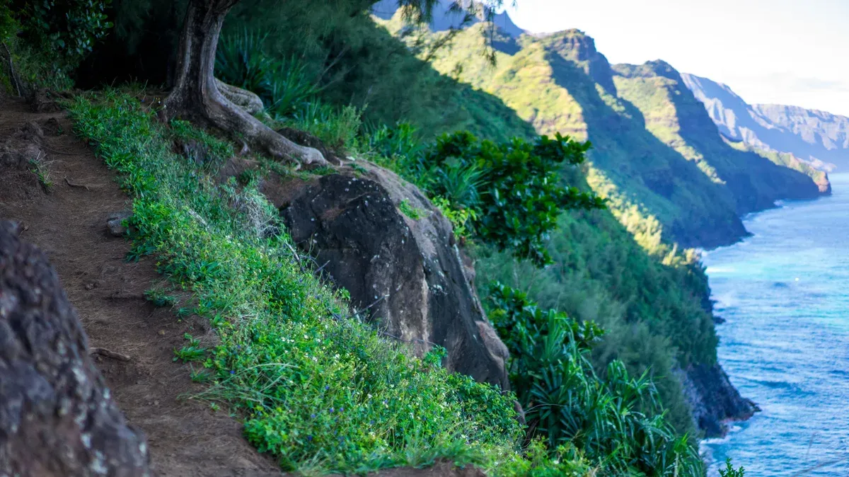
The Kalalau Trail runs along the green cliffs above the Na Pali Coast. Photo: California Cow from Seattle, USA, CC BY 2.0, via Wikimedia Commons
Quick answer Kalalau Trail in brief
The Kalalau Trail is 11 miles one way, or 22 miles round trip, from Kee Beach to Kalalau Beach on Kauai's Na Pali Coast. The first 2 miles to Hanakapiai Beach need no permit, only a Haena State Park entry reservation. Hiking past mile 2 requires a Na Pali Coast camping permit costing $35 per night for non-residents and $25 for Hawaii residents per DLNR, while Matador Network lists $20 per person per night for non-residents. The maximum stay at Kalalau is 5 nights. Hurricane Lowell closed all Kauai state parks from September 8, 2026, and the October 15, 2026 reopening notice listed the trail beyond mile 2 as closed until further notice, so check the official DLNR status before you plan anything.
Key takeaways
- Only the first 2 miles are a day hike. Beyond Hanakapiai Beach no day-use permits exist, so the full trail is an overnight trip by rule. See Haena State Park for the entry reservation you need at the trailhead.
- Prefer the cliffs from the water? The Na Pali Raft Snorkel runs 5.5 hours from Port Allen for $184.80 per person and enters sea caves when the ocean allows.
- Day hikers can add the falls side trip. The full route and its hazards are on the Hanakapiai Falls page.
- Short on time? A Sunset Dinner Cruise shows the same coastline in 3.5 hours for $247 per person, with dinner on board.
The Trail Mile by Mile
The Kalalau Trail was built in the late 1800s and crosses five valleys along the coast. The table below breaks the route into the segments hikers actually plan around.
Segments and Distances
The figures below come from Wikipedia's trail article, Matador Network's trail report and DLNR's own trail page. Distances are one way from Kee Beach, which sits at the end of Highway 560. The permit column shows the rule for each segment.
Note that no segment past mile 2 can be done legally as a day hike, even though some hikers attempt it in one long day.
| Segment | Distance | What is there | Permit |
|---|---|---|---|
| Kee Beach to Hanakapiai Beach | 2 miles | Moderately strenuous coastal path, Hanakapiai stream crossing at the beach | Haena entry reservation only |
| Hanakapiai Beach to Hanakapiai Falls | 2 miles inland | Waterfall of about 300 feet (one source gives 410), river crossings, flash-flood warning signs | Day hike allowed with Haena reservation |
| Hanakapiai to Hanakoa Valley | About 4 more miles (mile 6) | Climb from sea level to 800 feet over 1.25 miles after the beach | Camping permit required, 1 night at Hanakoa, no two consecutive nights |
| Hanakoa to Red Hill and Kalalau Beach | About 5 more miles (mile 11) | Red Hill descent of about half a mile to Kalalau Beach and Kalalau Valley | Camping permit, 5 consecutive nights maximum |
Terrain, Crawler's Ledge and the Streams
DLNR rates the full Kalalau Trail as difficult, with 800 feet of elevation gain recorded on the official trail page. The single hardest climb comes right after Hanakapiai Beach, where the path rises from sea level to 800 feet over just 1.25 miles. Farther on, Crawler's Ledge is the section hikers talk about most. Matador Network describes it as trail narrowing to a couple of feet wide, with a sheer cliff on one side and a drop straight to the Pacific on the other.
The trail crosses three major streams: Hanakapiai, Hanakoa and Kalalau. All three can rise rapidly in rain and flash flood, and Matador Network notes they can become impassable in heavy rain. A woman drowned in a flash flood at Hanakapiai stream in 2013. Hike With Ryan's advice is simple: never enter or cross floodwater when a stream is swollen. Wait it out.
The beach at the 2-mile mark carries its own warning. DLNR states that drownings occur regularly at Hanakapiai Beach because of rip currents. Wikipedia records about 30 documented drownings there between 1970 and 2010, with at least 15 bodies never recovered, and notes the nearest safe shore if you are swept out is roughly six miles away. There is no lifeguard and no cell service. Staying out of the water is the safe choice. Other recorded incidents include the rescue of 121 hikers over two days in 2014 and a hiker falling about 50 feet near mile marker 7 in 2014. Narrow sections, rising streams and falling rock are the standing hazards on the list.
Facilities along the way are minimal. DLNR lists composting toilets at Hanakapiai, Hanakoa and Kalalau, and no drinking water or tables anywhere on the route. Carry everything you need. If the legwork sounds like too much, a Na Pali Coast boat tour covers the same valleys and cliffs from the water without a step of it.
Permits, Reservations and Rules
Three separate bookings touch this trail: the Haena entry reservation, the Na Pali camping permit and, if you drive, a parking slot. Mixing them up is the most common way plans fall apart.
The Camping Permit
A valid Na Pali Coast camping permit is required to hike beyond Hanakapiai Beach, and no day-use permits are issued for that stretch. DLNR prices the permit at $25 per night for Hawaii residents and $35 per night for non-residents. The maximum stay at Kalalau is 5 consecutive nights, Hanakoa allows 1 night on a valid Kalalau permit with no two consecutive nights there, and Miloli'i allows 3 days.
Permits are released 90 days ahead and often sell out months in advance in summer. Camping without one is a petty misdemeanor, and illegal camping fines reach up to $500 for a first offense. Hike With Ryan notes the permit does not cover overnight parking or transport, which are booked separately.
DLNR's wording on whether the fee is per person or per campsite differs, and Matador Network lists $20 per person per night for non-residents, so confirm the price at checkout.
The Day-Hike Limit
Day hikers may go 2 miles, to Hanakapiai Beach, and no farther. DLNR's enforcement page says only permit holders may travel beyond Hanakapiai Stream, the 2-mile point of the 11-mile trail, and rangers patrol past the marker. Even a same-day out-and-back to Kalalau is not allowed without an overnight permit.
Enforcement is real: DLNR reports 104 citations for unpermitted camping since early 2016, and in early 2016 alone 2,400 pounds of human waste and over 4 tons of rubbish were airlifted out of the valley. Hawaii residents do not need a day-use reservation to hike to mile 2 but still need a permit beyond it.
The Haena Reservation
Every visit starts at Haena State Park, which caps entry at 900 people per day and requires an advance reservation through gohaena.com. Go Haena says reservations open 30 days ahead at 12am HST (the October 15, 2026 reopening notice says two weeks) and sell out within minutes, though Go Haena suggests checking between 7am and 8am for cancellations. Cancellations within 48 hours are nonrefundable with a 10% cancellation fee.
Overnight campers may no longer park at Haena at all and must arrive by shuttle or drop-off, and Haena parking for Kalalau campers is charged per day occupied, so one night means a two-day charge. Camping permit holders do not need a daily Haena reservation but must show the permit at the trailhead. Full parking prices, shuttle times and slots are covered on the Haena State Park page.
Closures and Current Status
Hurricane Lowell closed all Kauai state parks from September 8, 2026, including the Na Pali Coast. Haena State Park was listed as scheduled to reopen on October 15, 2026, and on that date day hiking to Hanakapiai Beach and the falls was open while the trail beyond mile 2 stayed closed until further notice. The DLNR reopening notice said all Kauai camping remained closed at that point.
None of this is a promise about today. Check the official DLNR and Hawaii State Parks pages for the current status before you book anything or drive to the trailhead.
Hiking the 11-Mile Kalalau Trail
A 4K film of the full 11-mile Kalalau Trail hike. Third-party video by Toby Visuals. This site did not shoot it and has no relationship with the creator.
Flash Floods, Surf and Heat
The Kalalau Trail has a real hazard record. Every figure below comes from state and reference sources, and none of it is decoration.
Stream Crossings and Flash Floods
The trail crosses three major streams: Hanakapiai, Hanakoa and Kalalau. All three can rise rapidly in rain and become impassable, turning a hike into a stranding. Hike With Ryan gives the rule plainly: do not enter or cross floodwater when streams are swollen.
In 2013 a woman drowned in a flash flood at Hanakapiai stream, a death recorded on the trail's reference pages. Islands.com reports that the stream inland of Hanakapiai Beach can become a fast river and has claimed more lives than the ocean itself. If water is high, wait or turn around.
The mountain rain that floods a stream often falls miles inland, far above the sunny crossing where you stand.
- Never cross a swollen stream, because the current is stronger than it looks and the depth can rise in minutes.
- Do not camp in a streambed, because flash floods arrive from rain you cannot see.
- Check the weather before and during the hike, because the three crossings are the trail's most repeated hazard.
The Hanakapiai Beach Drowning Warning
Hanakapiai Beach has sand in summer that powerful winter waves and high tides wash away. Wikipedia documents about 30 drownings there between 1970 and 2010, with at least 15 bodies never recovered. DLNR warns that drownings occur regularly at the beach due to rip currents.
There are no lifeguards, no cell service and no major reef to blunt the shore break, and the sand itself washes away under winter waves. If you are swept out, the nearest safe shore is roughly six miles away. Swim only in the Kee Beach lagoon at the trailhead, where a reef protects the water, and treat Hanakapiai as a dry-land lunch stop.
The unofficial tally sign at the beach showed 82 marks in 2014, and Wikipedia calls that count highly speculative, but the underlying warning is official.
| Hazard | Where | Documented record |
|---|---|---|
| Rip currents and shore break | Hanakapiai Beach | About 30 drownings 1970 to 2010, 15 bodies unrecovered |
| Flash flooding | Hanakapiai, Hanakoa and Kalalau streams | A drowning in 2013, streams rise rapidly in rain |
| Falling | Narrow sections near Red Hill, mile 7 | A hiker fell about 50 feet there in 2014 |
| Mass stranding | Whole trail | 121 hikers rescued over two days in 2014 |
Season and Current Status
Summer brings lower north-shore swell and steadier trade winds, the pattern that calms the water for Napali Coast boat tours. Wikipedia notes strong currents beyond the Kee Beach reef in winter and winter waves that wash the sand off Hanakapiai Beach. On the closure side, Hurricane Lowell closed all Kauai state parks from September 8, 2026, including the Na Pali Coast.
DLNR's reopening notice for Haena State Park, set for October 15, 2026, said all Kauai camping remained closed, and Hawaii Guide reported the trail beyond mile 2 closed until further notice while the day hike to Hanakapiai resumed. Nothing here predicts a reopening. Confirm the current trail and park status with Hawaii State Parks and gohaena.com before you drive, because these pages change fast after a storm.
- Carry more water than you think you need, because DLNR lists no drinking water anywhere on the trail.
- Pack out everything, because composting toilets exist at Hanakapiai, Hanakoa and Kalalau but there are no tables or services.
- Start early, because parking slots and shuttle departures are time-limited.
Sources: DLNR Kalalau Trail page and Wikipedia
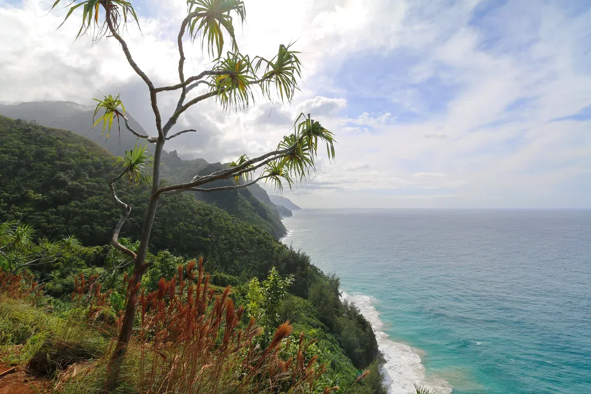
The view down the Na Pali Coast from the Kalalau Trail. Photo: Robert Linsdell from St. Andrews, Canada, CC BY 2.0, via Wikimedia Commons
The Same Coast Without the Hike
The 11 miles you would walk can also be seen from the water, and the water sees parts the trail never does.
Kalalau From the Ocean
Kalalau Valley's floor runs about 2 miles long and half a mile wide, ringed by cliffs more than 2,000 feet high. On foot it takes a permit and an overnight trip to stand in front of it. From the water it fills the horizon at once.
The state says boat is the only legal way to reach the Na Pali shore other than hiking, through permitted concessionaires, and no commercial boat may drop campers at Kalalau, so every cruise is strictly a look, never a landing. Compare the boats on the Napali Coast boat tours homepage, where the full range is listed side by side.
Which Tours Name Kalalau
Only one listing on this site names Kalalau Valley directly. The Sunset Dinner Cruise at $247 per person lists the cathedral cliffs of Kalalau Valley as a photo backdrop, and the route depends on ocean and weather conditions. The Snorkel Tour with Lunch runs past Polihale and north to the Na Pali sea cliffs for $215 per person.
The Zodiac Raft Sea Caves and Snorkel enters the sea caves along the coast at $225 per person when the ocean allows. The Niihau and Na Pali Full Day is a 7-hour trip at $339 per person that also snorkels at Lehua Crater. Note that the Snorkel Tour with Lunch and the Zodiac raft tours leave from Kikiaola Small Boat Harbor, which DLNR lists as closed until further notice after Hurricane Lowell, so confirm the departure point with the operator.
Sunset Over the Cliffs
If the hike is out, a sunset cruise still runs along the sea cliffs as the sun sets. The Sunset Dinner Cruise is a 3.5-hour catamaran trip at $247 per person with a Hawaiian-style dinner, drinks and a sunset champagne toast. The Lucky Lady Sunset Cruise runs 5 hours at $222.86 per person with a taco buffet and an open bar.
Summer is the calmer season for these runs, per operators, and winter brings humpback whales instead of flat water.
Kalalau Trail Tips
Five things that make the hike work, and four that end it.
Do
- Do book your Haena State Park reservation before anything else, because the park caps entry at 900 visitors a day and day-use slots open 30 days ahead and sell out within minutes.
- Do start the Hanakapiai hike early, because The Hiking Hi advises reaching the Kee Beach lot before 8am for parking.
- Do turn back at a rising stream, because the three crossings are the trail's deadliest hazard and one hiker has already drowned in a flash flood at Hanakapiai.
- Do carry all your own water and food, because DLNR lists composting toilets at Hanakapiai, Hanakoa and Kalalau but no drinking water or tables anywhere on the 11 miles.
- Do check the official park status the day before you go, because Hurricane Lowell closed all Kauai state parks from September 8, 2026 and the trail beyond mile 2 was still listed as closed until further notice in the reopening notice.
Don't
- Don't hike past Hanakapiai without a camping permit, because no day-use permit exists beyond mile 2, rangers patrol there, and violating the rules is a petty misdemeanor.
- Don't swim at Hanakapiai Beach, because DLNR says drownings occur regularly there from rip currents and about 30 deaths are documented between 1970 and 2010.
- Don't park along Kuhio Highway or outside the park, because Go Haena says parking violations draw tickets of $200 and up with possible towing.
- Don't rely on your phone at the beach or inland, because Hanakapiai has no cell service and the nearest safe shore if swept out is roughly six miles away.
Kalalau Trail Questions
Is the Kalalau Trail currently open?
Status has changed repeatedly. Hurricane Lowell closed all Kauai state parks from September 8, 2026, and the Haena reopening notice said the trail beyond mile 2 and all Kauai camping stayed closed until further notice, while day hiking to Hanakapiai was listed as open. Check the DLNR and Haena State Park pages before you go.
How dangerous is the Kalalau Trail?
Its hazards are documented, not rumored: about 30 drownings at Hanakapiai Beach between 1970 and 2010, a flash-flood drowning in 2013, 121 hikers rescued in two days in 2014, and a 50-foot fall near mile 7 the same year. Read the safety section above before deciding.
Can I see Kalalau Valley without hiking the trail?
Yes, from the water. Boat is the only legal way to reach the Na Pali shore other than hiking, and no landing is allowed at the camping areas. The boat trips on the Napali Coast boat tours homepage show the coast from the ocean, so check each listing for its route.
Which boat tour gets closest to Kalalau?
Rafts get closer than big catamarans. The Zodiac Raft Sea Caves and Snorkel ride at $225 per person is built to run into the sea caves and under the cliffs, though cave entry always depends on the ocean that day.
Is there a cheaper way to see the Na Pali Coast than hiking?
The lowest-priced trip on this site is the Na Pali Raft Snorkel at $184.80 per person for 5.5 hours from Port Allen, capped at 14 guests. Compare that with the cost of permits and shuttles for the full 22-mile round-trip hike.
What if I can't hike or boat the coast at all?
A helicopter is the remaining option, and flights and prices are covered on the Na Pali Coast helicopter tour page. Flight lengths and operators differ, so read that guide before booking.