 Napali Coast Boat Tours
Hanakapiai Falls: the Hike, the Hazards and the Reservations
Hanakapiai Falls is a waterfall about 300 feet (91 m) high by Wikipedia's figure on the Na Pali Coast of Kauai, reached on foot through Haena State Park. The route runs 2 miles along the Kalalau Trail to Hanakapiai Beach, then 2 more miles inland up the valley, with stream crossings along the way. This guide covers the distance figures, how long the round trip takes, the flash flood and rockfall hazards, the beach drowning warning and the Haena reservation you need before you start. If you would rather see this coast from the water, boat tours depart from Port Allen and Kikiaola. The bookable tours are compared on Na Pali Coast boat tours.
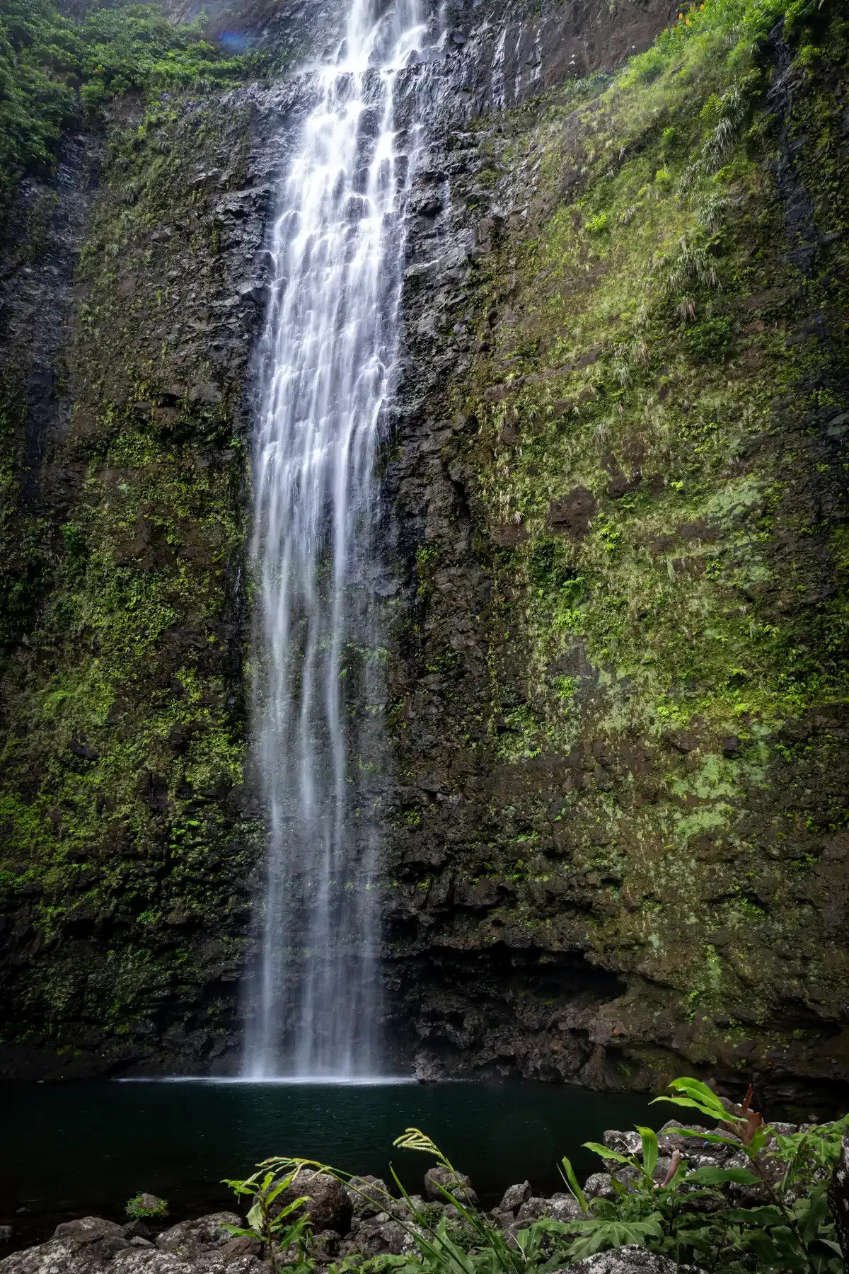
The lower part of the 300-foot Hanakapiai Falls in the Na Pali Coast region of Kauai. Photo: Christian Collins, CC BY-SA 2.0, via Wikimedia Commons
Quick answer Hanakapiai Falls at a glance
Hanakapiai Falls is a waterfall about 300 feet (91 m) high by Wikipedia's figure, while one hiking site gives 410 feet, in Haena State Park on Kauai's north shore. The hike is roughly 8 miles round trip: 2 miles of the Kalalau Trail from Kee Beach to Hanakapiai Beach, then 2 miles inland up Hanakapiai Valley to the falls. Hikers report 4 to 6 hours for the full round trip, with about 1,000 feet of elevation gain. A Haena entry reservation is required, and the stream crossings can flash flood.
Key takeaways
- The falls sit 2 miles past Hanakapiai Beach, itself 2 miles along the trail from Kee Beach, so most sources put the full hike at about 8 miles round trip.
- You cannot just drive up. Entry, parking or the shuttle are all reserved in advance, as the Haena State Park page explains.
- The stream crossings and the beach carry real risk: drownings at the beach are regular enough that DLNR warns about them on the Kalalau Trail page.
- Prefer a different angle on this coast? Compare Napali Coast boat tours, from raft trips into the sea caves to a sunset dinner cruise.
The Hike to Hanakapiai Falls
The route uses the first section of the Kalalau Trail and then a valley spur, and it is a strenuous day hike that needs no overnight permit.
Distance and Terrain, Leg by Leg
The figures below come from Wikipedia's Kalalau Trail and Hanakapiai Falls pages, DLNR's Haena access page and the Hiking Hi trail write-up. Wikipedia describes the beach leg as 2 miles (3 km) each way and the falls as about 2 miles (3.2 km) beyond the beach, which adds up to roughly 8 miles round trip, and DLNR's own access page also calls the falls hike about 8 miles round trip. Hiking Hi agrees on 8 miles out and back. The DLNR access page gives about 4 miles round trip to the beach and about 8 miles round trip to the falls.
The first 2 miles to Hanakapiai Beach are rated moderately strenuous by Wikipedia. Past the beach the route turns inland. For the falls hike specifically, Hiking Hi counts about 1,000 feet of elevation gain on the round trip and allows 4 to 6 hours. The inland section is not maintained to the same standard, with river crossings and flash-flood warning signs posted along it, and the trail is slippery when wet.
| Leg | Distance | Terrain | Note |
|---|---|---|---|
| Kee Beach to Hanakapiai Beach | 2 miles (3 km) | Moderately strenuous coastal trail | No permit needed beyond a Haena reservation |
| Hanakapiai Beach to the falls | About 2 miles (3.2 km) | Inland valley trail with river crossings | Unmaintained sections, slippery when wet |
| Full round trip | About 8 miles | About 1,000 ft elevation gain | Hiking Hi allows 4 to 6 hours |
| Beach only round trip | About 4 miles | Same first leg, out and back | DLNR access page figure |
| State Parks timing for the beach leg | 3 to 4 hours round trip from Kee | Quoted by Islands.com | Applies to the beach, not the falls |
What You Find at the Falls
Hanakapiai Falls is about 300 feet (91 m) high by Wikipedia's figure, while The Hiking Hi gives 410 feet. Hanakapiai means 'bay sprinkling food' in Hawaiian. The stream that feeds it is the flood hazard on this hike, because streams on this trail rise rapidly in rain.
DLNR lists composting toilets at Hanakapiai but no drinking water and no tables anywhere on the trail, so carry everything in and carry it out. DLNR also lists falling rock among the general hazards of the trail, so pick a resting spot away from overhangs.
Streams, Rocks and the Beach
Three separate hazards cause the rescues and drownings on this route, and all of them are documented rather than theoretical.
Flash Floods at the Crossings
The inland leg has river crossings, and Wikipedia lists Hanakapiai stream as one of the three major stream-crossing hazards on the Kalalau Trail alongside Hanakoa and Kalalau streams. These crossings flash flood and become impassable in heavy rain. The record shows what that means: a woman drowned in a flash flood at Hanakapiai stream in 2013, and Islands.com reports the stream can turn into a fast river and has claimed more lives than the ocean at the beach.
In 2014, 121 hikers were rescued from the trail over two days. The rule from Hike With Ryan is simple: do not enter or cross floodwater when streams are swollen. If the water is brown, fast or rising, turn around.
There is no cell service at Hanakapiai Beach, so you cannot count on calling for help.
Falling Rock on the Trail and at the Pool
DLNR lists falling rock among the general hazards of the Kalalau Trail, along with narrow sections and rapidly rising streams. In 2014 a hiker fell about 50 feet near mile marker 7 on Red Hill, further along the same trail system. For the falls hike, the practical step is to keep moving through the boxed-in parts of the valley trail, choose a resting spot in the open, and never set up directly under the cliff walls or the wet rock beside the falls themselves.
The Beach That Drowns Swimmers
Hanakapiai Beach looks swimmable in summer, when its sand shows, but Wikipedia notes powerful winter waves and high tides wash the sand away entirely, and the beach has strong rip currents, shore break and no protecting reef. There are no lifeguards and no road access. DLNR warns plainly that drownings occur regularly at Hanakapiai Beach due to rip currents.
The numbers are grim: about 30 documented drownings between 1970 and 2010, with at least 15 bodies never recovered, and the nearest safe shore if you are swept out is roughly six miles away. The unofficial tally sign at the beach showed 82 marks in 2014, a count Wikipedia itself calls highly speculative. The sign exists so you do not need one more mark: swim at Kee Beach inside the reef lagoon instead, and treat Hanakapiai as a rest stop and a lunch spot, not a swimming hole.
Hanakapiai Falls Hike Guide
A hike guide to Hanakapiai Falls and Hanakapiai Beach on Kauai. Third-party video by The Virtual sherpa. This site did not shoot it and has no relationship with the creator.
Reservations to Reach the Trailhead
Most hikers need a Haena reservation, and day-use slots sell out within minutes of opening.
Entry, Parking and the Shuttle
Haena State Park caps visitors at 900 people a day, and access runs through gohaena.com. Day-use reservations open 30 days ahead at 12am HST per Go Haena and DLNR's park page (the October 15, 2026 reopening notice said two weeks) and sell out within minutes, though unsold slots from cancellations are best checked between 7 and 8am. Hawaii residents with ID do not need a day-use reservation to hike to mile 2.
You have two ways in: reserve a parking timeslot in the park (the booking engine shows $20 per car per timeslot plus $5 per person, though the state page lists $10 per vehicle, so confirm the price at checkout), or ride the shuttle, which is $45 for adults and $25 for ages 4 to 15 and runs from 6:20am to 6:40pm from Waipa Park & Ride or Princeville, with the last Princeville departure at 9:00am. Overnight campers can no longer park at Haena at all and must arrive by shuttle or drop-off. Do not park along Kuhio Highway: Go Haena warns of $200+ tickets and possible towing.
The full picture of fees, hours and the 900-person cap is on the Haena State Park page.
Timing Your Start
The parking lot opens at 6am, and Go Haena lists the park as open 7am to 6:45pm (DLNR lists 7:00 am to 7:45 pm from April 1 to Labor Day). Hiking Hi's advice is to arrive at the Kee Beach lot before 8am, which helps secure parking for a hike that takes 4 to 6 hours round trip. Summer is when Hanakapiai's sand shows, since powerful winter waves and high tides wash it away.
Sources: gohaena.com, DLNR
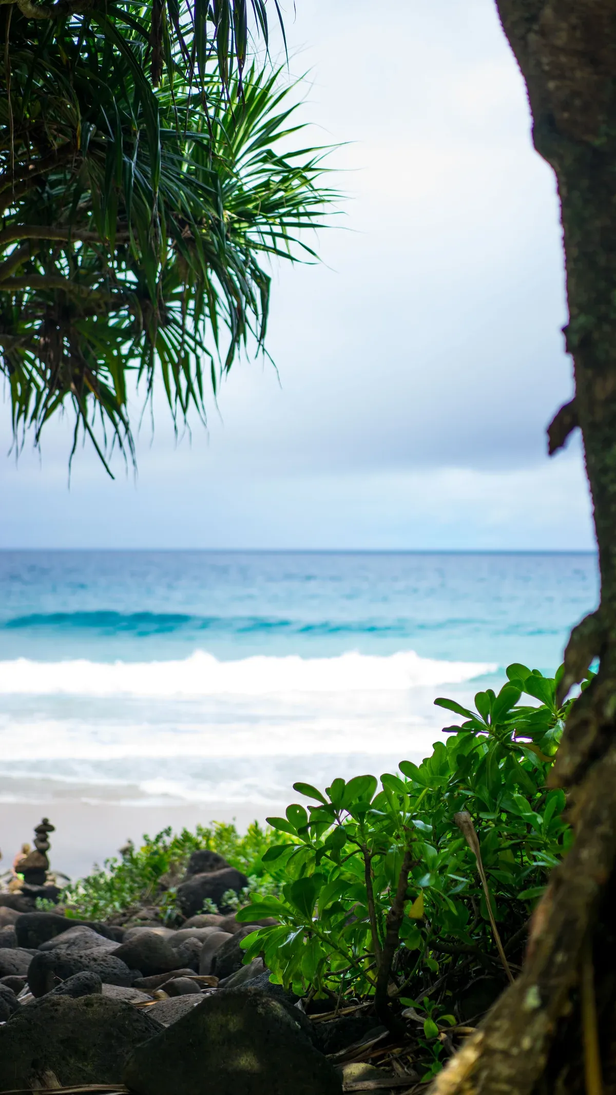
The surf at Hanakapiai Beach on the Na Pali Coast framed by trailside trees. Photo: California Cow from Seattle, USA, CC BY 2.0, via Wikimedia Commons
The Coast Past Hanakapiai
The hike gets you into one valley. Boat tours show you the rest of the Na Pali Coast, the part no trail reaches.
Why Boats and Hikes Are Different Trips
The Kalalau Trail ends at mile 2 for day hikers, so Hanakapiai is as far as most people get on foot. From the water, a boat trip shows the 16 to 17 miles of cliffs, with sea caves on some trips and valleys such as Kalalau that have no road. Raft tours such as the Na Pali Raft Snorkel, $184.80 per person on a raft capped at 14 guests, enter sea caves and pass under waterfalls when weather allows.
Catamarans like the Holo Holo Sail and Snorkel, $274 per person for 5 hours with breakfast and lunch included, work the same coastline with a snorkel stop. Boats leave from Port Allen and Kikiaola on the west side.
Seeing It Both Ways
Hiking and boating complement each other rather than compete: the hike gives you the valley and the falls up close, the boat gives you the scale of the cliffs and the caves. One honest note on timing: Hurricane Lowell closed all Kauai state parks from September 8, 2026, and Haena State Park was listed as scheduled to reopen on October 15, 2026 with day hiking to Hanakapiai Beach and Falls open while the trail beyond mile 2 stayed closed until further notice. Kikiaola Small Boat Harbor was listed as closed until further notice, so raft tours that normally leave from Kikiaola may depart elsewhere or not at all.
Check the official park status and confirm the departure point with the operator before you commit to either plan. If you would rather end the day than start it, the Sunset Dinner Cruise runs 3.5 hours from Port Allen at $247 per person with dinner and drinks included.
Sources: Beat of Hawaii, DLNR
Do and Don't on the Hanakapiai Falls Hike
Do
- Do reserve your Haena entry 30 days ahead at 12am HST, because day-use slots sell out within minutes.
- Do start before 8am, because Hiking Hi recommends arriving at the Kee Beach lot before 8am for parking and the round trip takes 4 to 6 hours.
- Do carry all your own water, because DLNR lists no drinking water anywhere on the trail, only composting toilets at Hanakapiai.
- Do turn back if a stream is brown, fast or rising, because Hike With Ryan's rule is not to enter or cross floodwater and the Hanakapiai stream has killed hikers in flash floods.
- Do check for cancellation slots between 7 and 8am, because Go Haena says unsold slots from cancellations surface in that window.
Don't
- Don't swim at Hanakapiai Beach, because DLNR warns drownings occur there regularly due to rip currents and about 30 drownings are documented between 1970 and 2010.
- Don't walk past Hanakapiai Beach without an overnight Kalalau permit, because day-use permits are not issued beyond the beach and going further is a petty misdemeanor, with rangers patrolling past the 2-mile marker.
- Don't park along Kuhio Highway, because Go Haena warns of $200+ tickets and possible towing, and Hawaii Guide reports there is no legal roadside parking in Haena.
- Don't assume the trail is open when you arrive, because Hurricane Lowell closed Kauai state parks from September 8, 2026 and status changed repeatedly, so confirm on the official park pages before you drive to the trailhead.
Hanakapiai Falls FAQ
How long is the hike to Hanakapiai Beach?
About 2 miles (3 km) each way from Kee Beach, which Wikipedia rates moderately strenuous, so 3 to 4 hours round trip by State Parks' recommendation.
How tall is Hanakapiai Falls?
About 300 feet (91 m), the figure Wikipedia gives and the one most widely quoted, though one hiking site puts it at 410 feet. The falls are the turnaround point of the day-hike section of the Kalalau Trail.
Do I need a permit to hike to Hanakapiai Falls?
No overnight permit, but you do need a Haena day-use entry reservation, which opens 30 days ahead and sells out in minutes. The fees and booking windows are covered on the Haena State Park page.
Can you swim at Hanakapiai Falls?
The stream feeding the falls can flash flood and the beach on the way in has rip currents and no lifeguards, so neither spot is a casual swim. The safety section above has the detail.
What is the most famous waterfall in Kauai?
This page does not rank Kauai's waterfalls. Hanakapiai Falls is about 300 feet (91 m) high and takes an 8-mile round trip on foot. If hiking is not on the cards, some Napali Coast boat tours pass under waterfalls when the weather allows.
Why do boat tours not leave from Hanalei for Hanakapiai?
The boat tours on this site depart from Port Allen in Eleele and Kikiaola Small Boat Harbor on the west side, not from the north shore trailhead. The Napali Coast boat tours comparison lists the harbor for each trip.